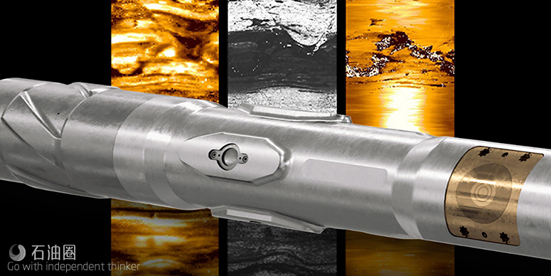
Schlumberger Unveils TerraSphere high-definition dual-imaging-while-drilling service
The new service, TerraSphere, introduced at the SPE Offshore Europe Conference and Exhibition in Aberdeen, applies a logging-while-drilling dual-physics imager for oil-based mud for drilling oil and gas wells.
TerraSphere* high-definition dual-imaging-while-drilling service delivers industry-first high-resolution resistivity images in OBM. It also provides high-resolution acoustic images and caliper data while drilling in OBM systems. TerraSphere service uses electromagnetic and ultrasonic measurements to provide high-resolution images of the borehole in real time while drilling.
The electromagnetic subsystem uses two electrodes 180 degrees apart. High resolution electromagnetic pulses are sent through the mud from the sensor to the formation at multiple frequencies. The wide range of firing frequencies produces the best quality resistivity image across the broad range of resistivities encountered in subsurface geological environments. This has been proved in clastics, carbonates, shales, and evaporites.
The acoustic subsystem uses four ultrasonic transducers 90 degrees apart. These emit short ultrasonic pulses and detect the resulting echoes from the borehole wall. These provide robust measurements in high-mud-weight drilling fluids with high attenuation, as well as in boreholes with lighter muds and good hole conditions. Each transducer is focused for optimum resolution and to reduce sensitivity to tool eccentricity and borehole roughness or diameter changes. Two measurements are made: The first is travel time, which is converted to borehole radius using calculated acoustic velocity of the drilling fluid; and the second is echo amplitude, which responds to acoustic impedance of the borehole wall. Numerous bursts are made in each rotation of the drilling assembly to provide an azimuthal image. The high sampling rates and focusing of the sensors deliver a resolution comparable to wireline ultrasonic imaging tools in OBM and water-based mud (WBM) systems.
Resistivity borehole images are usually the preferred physics for geological applications as they have the largest dynamic range and highlight subsurface features a small distance past the borehole wall. The ultrasonic measurements are very sensitive to variations in the surface of the borehole such as fractures, vugs, rugosity, and ledges. Detailed rock fabric can also be imaged where the acoustic contrast is present and the borehole surface is smooth. TerraSphere service co-locates these image physics in a single tool, providing a complete solution for detailed geological and borehole understanding in OBM environments while drilling. The images are complementary, with the resistivity images rich in bedding features and the ultrasonic images more sensitive to fractures and borehole conditions.
APPLICATIONS
Geoscience solutions for complete reservoir description in oil-based mud (OBM);
Structural analysis, sedimentology, and sequence stratigraphy;
Sourceless geosteering with resistivity or ultrasonic images, or both, in real time while drilling;
Real-time geomechanics and wellbore stability;
Lithology and facies identification;
Fracture identification and characterization;
360 degree detailed borehole shape and deformation analysis with calipers.
More than 30 field trials were conducted with the TerraSphere service in the Gulf of Mexico, Middle East, North Africa, North Sea and US land. These trials included imaging for structural and stratigraphic analysis, revealing breakout fractures that enabled drillers to avoid mud loss, Schlumberger said, adding, the new service acquired additional and higher definition data, reducing subsequent operational time and improving net-to-gross ratio in the payzone.
In the North Sea, a customer used the TerraSphere service in a complex reservoir in Balder Field. Dual imaging while drilling delineated sand injectites in the reservoir and removed ambiguity from conventional logs, providing more accurate characterization through increased reservoir coverage to maximize production potential. The resolution captured by ultrasonic images is now refined to millimeters—previously possible only with wireline imagers.
“Drillers have been unable to visualize, in real time, subsurface features when drilling with oil-based mud,” said Tarek Rizk, president, Drilling & Measurements, Schlumberger. “The TerraSphere service delivers geological and geomechanical data that not only saves logging time and related rig costs, but also reduces the potential risk for lost circulation of drilling muds into formation fractures.”

 石油圈
石油圈
