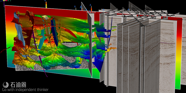
GEOenhanced带来的勘探技术不仅在油气勘探中非常有效,还能在其它资源勘探中发挥作用。
编译 | 惊蛰
GEOenhanced Technologies公司成立于2016年,旨在开发一套用于石油、天然气、矿产或水资源勘探的4D地震成像系统,并将其推向市场。该专利技术通过地下分析,可定位识别并量化液态或气态碳氢化合物、水或其他矿物。独特的震电施工原理,无需钻打任何孔洞,能够省去能源工业和矿产勘探中钻打“干井”等成本支出,还能获取4万英尺深处的地层孔隙度。如果地下有油气等液体存在,该系统不仅能显示其体量、深度和组成,还能显示流动方向。基于这些信息,可大幅降低钻井和运营成本,提高单井产能。
震电服务
该公司的地震成像服务面向全球公司和个体客户。与三维地震等技术相比,该技术具有快速、高效、不受地形和地理位置限制等特点,是油气勘探领域的一把利器。
基于早期的地震探测研究,进而成功研发出震电成像技术。它是基于高能震动(例如地震)发生后的次生事件Biot波动理论来识别地下电阻率对比。其虚拟了一个高能震动事件,体波(P波和S波),面波(Rayleigh波和Love波),以及随后沿地层向下传播的震电波和Biot波。由于油气储层具有电阻性,该技术会导致包裹岩石的原子与目标地层孔隙中的物质之间的接触中断。
由于地层受到震电波的轻微压缩,地层中的每种物质都会释放出一种独特的低能信号,该公司设计的独特天线能接收这些信号并将其可视化。在这种条件下,震电波可以传导到4万英尺的垂直深度。根据天线接收到的数据,可以立即推断出地层的深度和厚度、矿床类型(贵金属、钻石)、地层中存在的溶液或混合物类型(液态石油或天然气)、水(盐水、淡水、地热水)、地层相对电荷及压力。
此外,利用该技术,还可以推断出地层类型(砂岩、碳酸盐岩、页岩、与页岩互层的泥沙等)。经过仔细研究,可以推断出一个特定地点的相对产量。经过进一步的数据处理和建模分析,包括数据的反演和深度偏移,生成地图、剖面和三维图像,还可以显示电阻体的精确位置和深度。
值得一提的是,该技术不仅适用于油气行业,在其它资源的勘探中也能发挥巨大作用。最近,GEOEnhanced Technologies公司在美国北达科他州和南达科他州完成了一系列应用专有震电勘探技术的测试工作。此举是应当地的邀请,来证明该技术在地下地质成像方面(包括获取孔隙度参数)的有效性。
GEOEnhanced科学与发展副总裁Adrian Garcia评论道:“当地部落委员会对了解地下情况非常感兴趣,而且美国联邦政府也已经为该项目批拨专款。当前,部落正在努力寻找能够迅速发展的农业项目,其首要任务就是找到新的淡水资源,以支持种植农作物和饲养牲畜。我们公司的地震成像团队已经花费数天时间来研究不同区域的地下情况,以展示这项技术在4万英尺深处的有效性。在过去的几个月里,我们一直在努力与部落委员会达成一项长期合同,为所有150万英亩的土地提供地震成像服务。通过前述的有限测试来展示我们技术的有效性,是达成此项协议的关键。”
该公司公布了测试的细节内容,在部落土地上总共选取了12个测试点,覆盖了北达科他州和南达科他州的地区。虽然Garcia并未透露测试结果,但他相信委员会对他们土地下面的情况会非常感兴趣。“仅仅知道那里有什么是重要的第一步,这样就可以制定计划来利用他们的自然资源。我们很高兴能与大家分享这些初步成果。”
公司CEO Craig Fischer评论道:“GEOEnhanced即将推出无人机地震勘探服务,可以规避典型的起爆地震勘探方式对环境的影响,因而非常适合这个项目。目前,我们拥有专利权的4D地震成像技术在石油和天然气行业处于领先地位,正在逐步获得客户的认可。”
For English, Please click here (展开/收缩)
GEOEnhanced Technologies recently completed a series of tests using its proprietary electro-seismic technology in North and South Dakota on Native tribal lands. The test was conducted at the invitation of the tribal council to demonstrate the effectiveness of the GEO technology for imaging subsurface geology, including porosity.
Adrian Garcia, vice president of science and development for GEOEnhanced, commented, “The tribal council is very interested in knowing what lies below the surface of their land and, in fact, has U.S. federal grant money allocated specifically for that purpose. Foremost on their list is finding new fresh water sources that can be tapped for crops and livestock as the tribe seeks to foster their burgeoning agricultural program. Our seismic imaging team recently spent several days shooting various sections of their land to show the effectiveness of the technology at depths up to 40,000 ft. This week we are returning to present our findings to the council. We have been working over the past months to secure a long-term contract to image all 1,500,000 acres of the tribe’s land. Showing the effectiveness of our technology in a limited test was a critical piece to completing this transaction.”
The company released details of the test indicating that a total of twelve test shots were performed at locations selected by the tribe and covering areas in both North and South Dakota. While not disclosing the results of the tests, Mr. Garcia indicated that he believed the council will be interested to know what lies beneath their land. “Just knowing what is down there is an important first step so that a plan can be developed to capitalize on their natural resources. We’re excited to share these initial results.”
Craig Fischer, company CEO, commented, “GEOEnhanced’s forthcoming seismic drone application is ideally suited for this and other projects by avoiding environmental impacts of typical dynamite seismic shots. We are continuing to gain acceptance of our industry leading and proprietary 4-D seismic geologic imaging product in the oil and gas industry.”
GEOenhanced Technologies was founded in 2016 to develop and bring to market a 4D seismic imaging system for oil, gas, mineral and water exploration. The proprietary technology conducts subsurface analysis in order to locate, identify, and quantify liquid and gaseous hydrocarbons, water, and other minerals. The electro-seismic process can eliminate “dry hole” and other exploratory costs in both the energy industry and mineral exploration. Unlike other seismic imaging devices, GEO’s system works without drilling any holes and also gives a reading on porosity at depths up to 40,000 feet. In the case of subsurface liquids, the system is able to show not only the size, depth and composition of the material, but also the direction of flow. This information greatly reduces drilling and operating costs and increases well productivity.
Electroseismic Services
We provide electroseismic services to companies and individuals across the globe. With this technology, we have the unique ability to survey for hydrocarbons faster, more efficient, and not bound by terrain and geolocation compared to technologies such as 3d seismic.
Electroseismic Explained
Discovered while researching early earthquake detection, our Electroseismic imaging is based upon Biot Wave Theory created as a secondary event after a high energy seismic event occurs (earthquake) to identify subsurface resistivity contrasts. We recreate a High Energy Seismic Event, directing P and S waves, Rayleigh Waves, Love Waves, and Electroseismic or Biot Waves that subsequently travel down the stratigraphic column. Hydrocarbon reservoirs are electrically resistive, so our technology causes a disruption between the contact of the atoms of the encasing rock and the substance trapped in pore spaces of the target formation. As the formation is slightly compressed due to the Electroseismic waves striking it, a unique low energy signal is released for each substance present in the formation. Our finely-tuned, non-traditional antennae receives the data and translates it into a visual form. This can create conditions under which Electroseismic energy can be directed up to 40,000 feet in vertical depth. From the data our antennae receives, we can immediately deduce the depth and thickness of the formation, type of deposit (precious metals, diamonds) the type of solution or mix present in formation (liquid petroleum or natural gas), water (saltwater, freshwater, geothermal water), and relative charge, or pressure of the formation.
We can also deduce the type of formation ( sandstone, carbonate, shale, silt interbedded with shale, etc). After careful study, we can deduce the relative production that can be expected at a specific site. Further processing and modeling is then used, including inversion and depth migration of the data, resulting in maps, cross sections and 3D volumes that show the exact location and the depth of resistive bodies.
未经允许,不得转载本站任何文章:

 石油圈
石油圈
