油藏监测服务巨头Ikon Science又有新作推出了!
来自 | Ikon Science
编译 | TOM 惊蛰
Ikon Science近期发布了油藏监测服务RokDoc 6.6.0,其中还包括新型的RokDoc 4D油藏监测产品。Ikon公司一直致力于帮助油气公司提高效率、降低成本,最大限度地提高投资回报率,产品的升级换代也表明了技术的进步。
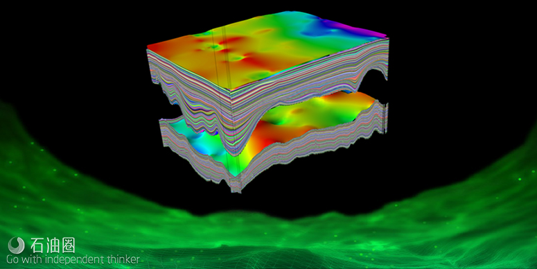
RokDoc油藏监测产品提供了许多新功能。RokDoc能够将静态(地理模型)与动态(流动模拟)属性模型集成到3D / 4D共享岩土模型中,可用于4D时移可行性与“闭环”工作流程。利用这个全面的新工具包,开发团队协同工作效率更高,使用4D地震数据及其他来源的信息,更新地质模型与模拟数据。
David H. Johnston博士是一位油藏描述与延时地震领域的专家,他说:“建立油藏的地质、工程特性与地震特性之间的岩石物理关联,对于4D解释至关重要。Ikon Science公司的RokDoc提供了估算储层弹塑性的必要工具,并确定了岩性、应力、温度与流体饱和度对储层弹塑性的影响。将模拟地震模型集成到RokDoc中,增加了4D数据对商业决策产生积极影响的可能性,从而可增加储量、采收率以及产量。”
Ikon Science正在开发企业信息管理领域的新产品。其运用机器学习方法来定量解释,在企业信息管理系统中获取、汇总以及管理岩石属性信息,以便随时可以识别、提取以及提供高质量数据,用于机器学习算法的训练。然后,可将机器学习算法快速部署于各个油田区块,为地下勘探、开发以及钻井的挑战提供解决方案。
RokDoc 6.6.0对井筒大型数据集处理的可用性与工作流程进行了大量改进,并在软件中增加了新的多井选择功能。为了响应客户的反馈,RokDoc 6.6现在支持加载、操作与转换不规则偏移的数据集,这在陆地项目中很普遍。
如今,终端用户可从井内岩石物理、压力、常规与非常规储层的地质力学分析,无缝过渡到数据驱动的3D地震储层特征。并且,在单一、统一的平台上提供地质力学、岩石物理以及弹塑性模型的3D分析。
全球投资组合经理Kester Waters表示:“全球众多油气区块进入了后期生产以及退役的新阶段,因此技术需要与时俱进,以使后期生产具有经济效益,并保留重要基础设施。为了实现这一目标,我们需要处理更大、更复杂、更古老的数据集,并应用相关算法,在空间、时间上以更高的分辨率提供更多信息。这个软件的新版本可提供解决方案,帮助我们的客户做到这一点。”
在最新的工具包中,用户可以将静态与动态地质特征模型,与实验室、岩心、井以及地震数据相结合,生成4D岩石弹塑性模型,用于4D可行性以及时移地震解释。4D框架提供了出色的建模灵活性,允许用户根据地震观测,快速、轻松地识别与测试地质情况。主要特点包括:兼容Petrel软件、导入并组合多个跨模型的CPG、4D数据分组/处理、复杂的地质统计学与4D岩石物理建模、基于时间的时间-深度关系、后/叠前综合建模、后/叠前噪声建模、查看日期控制的4D剩余油。
随着油田的老化,即将面临昂贵的退役成本,这就要求:延长油田寿命并抵消退役成本;最大限度地在后期生产中恢复经济效益;经济开发加密井以及边际油藏;4D信息研究的有效价值。
然而,氮气油田管理与作业效率低下,存在如下问题:提高采收率支出高;泄油面积无法达到预期效果;采收率低于预期值;加密井的验证、风险以及评定难度大;压力变化影响钻井安全窗口以及井眼的完整性。
此外,产量预测与历史数据拟合的不确定性提高了油藏开采难度,主要问题包括:静态与动态模型的更新未充分利用地震数据;无法快速更新工程模型,无法探索与验证生产方案。
RokDoc油藏监测技术能够快速构建与研究完整的弹塑性共享岩土模型,以识别出4D信息中的价值;针对未来设施与开发要求的快速建模;整合多学科数据,并规划有效的4D工作计划。
快速识别开发与生产策略中的低效率:优化计划进行以及正在进行的油藏开发作业;检测油藏与油井完整性,以识别例如区域外的注水;提供积极主动的油井储量与采收率的管理计划,以优化驱动例如引导注水;优先钻价值最高的井。
精确探测、获取以及整合4D地震数据,提供更先进的历史拟合:根据地震数据,快速、轻松的评估与验证生产方案;工程、地质与地球物理学科之间的有效沟通;单一平台、与第三方软件的兼容,可减少时间的浪费,并改善数据传输效率;基于强大的4D地震解释优化工程模型。
For English, Please click here (展开/收缩)
Ikon Science announce that RokDoc 6.6.0 is to be released during the SEG 2018 including the launch of a new RokDoc 4D Reservoir Monitoring product. This release demonstrates Ikon’s continuing focus on enabling E&P companies to improve efficiencies, reduce costs and maximise ROI.
RokDoc Reservoir Monitoring offers significant new functionality. RokDoc now supports corner point grid data, allowing the integration of static (geomodel) and dynamic (flow simulation) property models into 3D/4D shared earth models that can be utilised for 4D time lapse feasibility and ‘close the loop’ workflows. Using this comprehensive new toolset, asset teams can work collaboratively to update geomodel and simulation data with information from 4D seismic and other sources.
David H. Johnston, PhD, PG, an expert in the field of reservoir characterisation and time-lapse seismic, commented ‘’Establishing the rock physics link between the geological and engineering properties of a reservoir and its seismic properties is essential to 4D interpretation. Ikon Science’s RokDoc provides the tools necessary to estimate the reservoir’s elastic properties and determine how they depend on the rock properties, stress, temperature, and fluid saturation. Simulation-to-seismic modelling, now integrated within RokDoc, increases the odds that 4D data will positively impact business decisions resulting in increased reserves, recovery, and production rates’’.
Ikon Science is developing new offerings in the field of Corporate Knowledge Management. Ikon’s machine learning approach to quantitative interpretation involves the capture, aggregation and management of rock property information in a corporate knowledge management system so that it is then possible to identify, extract and deliver high-quality data for training of ML algorithms. ML algorithms can then be rapidly deployed across assets delivering novel solutions to subsurface E&P and drilling challenges.
RokDoc 6.6.0 see’s numerous usability and workflow improvements for the handling of large well datasets, with the addition of new multi-well selection capabilities across the software. In response to customer feedback, RokDoc 6.6 now supports the loading, manipulation and conversion of gather datasets with irregular offsets, common in land-based projects.
End users can now move seamlessly from well-based rock physics, pressure and geomechanical analysis of conventional and unconventional reservoirs through to data-driven, 3D seismic reservoir characterisation, delivering 3D analytical geomechanical, petrophysical and elastic property models in a single, unified platform.
Kester Waters, Global Portfolio Manager – Reservoir commented ‘’with numerous oil and gas basins across the globe entering into a new era of late stage production and decommissioning, it is more important than ever that technology keeps pace and enables economic tail end production to be realised and vital infrastructure to be preserved. In order to achieve this goal, we need to handle larger, more complex, multi-vintage datasets and apply algorithms that are capable of delivering more information both spatially and temporally and at a higher resolution. This new software release is delivering solutions that help our clients to do that’’.
In this latest addition to the tool kit, users can integrate static and dynamic geological property models with lab, core, well and seismic data to generate 4D petro-elastic models for 4D feasibility and time lapse seismic interpretation. The 4D framework delivers exceptional modelling flexibility allowing users to quickly and easily identify and test geological scenarios against seismic observations. Key features include; connectivity to Petrel*, import and combine multiple CPG’s across a model, 4D data grouping/handling, sophisticated geostatistics and 4D rock physics modelling, date varying time-depth relationships, post/pre-stack synthetic modelling, post/pre-stack noise modelling, view date control and 4D residuals.
Industry Challenges
Significant decommissioning costs approaching as basins mature
- Requirement to prolong field life and offset decommissioning
- Maximise economic recovery from tail end production
- Economic exploitation of small infill opportunities and satellite hydrocarbon pools
- Effective value of information studies for 4D
Inefficiencies in field management and operations
- Minimise well spend
- Drainage strategies not performing to expectation
- Recovery rates lower than desired
- Inconsistent validation, risking and ranking of infill hydrocarbon targets
- Stress changes impacting drilling windows and well bore integrity
Uncertainty in production forecasting and history matching
- Seismic not fully utilised in static and dynamic model updates
- Inability to quickly update engineering models and explore and validate production scenarios
RokDoc Reservoir Monitoring
Robust: Establish and implement 4D projects to prolong field life
- Rapidly construct and investigate integrated elastic shared earth models to identify value of information of 4D
- Fast 4D modelling for future facilities and development requirements
- Integrate data across multiple disciplines and plan effective 4D work programmes
Fast: Rapidly identify inefficiencies in the development and production strategy
- Optimise planned and on-going reservoir development activities
- Monitor reservoir and well integrity to identify e.g. out-of-zone injection
- Deliver a pro-active well stock and rate management plan to optimise drive e.g. steer the waterflood
- Drill highest value wells first
Accurate: Explore, capture and integrate 4D seismic to deliver improved history match
- Quickly and easily evaluate and validate production scenarios against seismic data
- Effectively communicate between engineering, geological and geophysical disciplines
- Single platform, with connectivity to third-party software reduces time wasted and inefficiencies in data transfer
- Optimise engineering models based on robust 4D seismic interpretation
未经允许,不得转载本站任何文章:

 石油圈
石油圈
