Thousands of professionals within the geosciences sector gather annually to learn industry best practices with the newest technologies. This year, the Society of Exploration Geophysicists (SEG) International Exposition and 88th Annual Meeting is taking place Oct. 14-19 in Anaheim, Calif.
The following is a sampling of some of the latest technologies and products that will be showcased at the SEG conference.
Automate processes critical to recovery of hydrocarbons
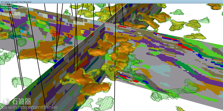
At the SEG conference, Emerson’s E&P Software and Services business will feature applications of machine learning to geophysical data and methods as a visible and impactful component of the industry’s digital transformation, a transformative effort to automate, integrate and improve processes and deliverables that are critical to the location and recovery of hydrocarbons. Key highlights include 1) applications of deep learning to full-azimuth “directivity gathers” to image subsurface features such as faults, salts and reefs—a game-changing step toward automatic interpretation of prestack data, and 2) creative use of ensembles of neural networks to generate probabilistic facies models from seismic data and wellbore data for a better understanding of reservoir heterogeneities. The program also will include the use of machine learning methods to automate Big Loop workflows, from seismic data to reservoir simulation, incorporating geophysical uncertainties for better production forecasting and accelerated project turnaround times. emerson.com
A move to cloud computing
In a move to increase efficiencies, lower operating costs and decrease project turnaround time, Fairfield Geotechnologies has completely transitioned its seismic data processing to cloud-based computing. Cloud computing provides on-demand burst capacity that reduces the need to invest in fixed assets (computing and infrastructure), removes concerns about “peak” load and over-provisioning of hard assets, allows provisioning of resources to satisfy any client demand, eliminates maintenance issues and provides automatic technology refresh. Seismic data processing is well-suited to the coarse-grained distributed processing that web-based solutions provide. In seismic imaging, for instance, the problem can be broken into small pieces that can be independently solved in a parallel manner by many CPU cores. From an efficiency perspective, cloud computing provides a scalable solution for accepting processing jobs too large for fixed, on-premises compute capacity; reduces run time for individual processing jobs, improving analyst’s productivity; compresses project turnaround; and increases total project throughput. fairfieldgeo.com
Isolate, investigate areas of interest in neural classification volumes
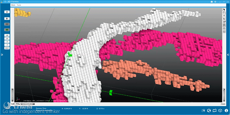
Geophysical Insights has released the new Geobody Analysis capability in the Paradise machine learning platform. Geobody Analysis is a result of machine learning that enables geoscientists to isolate and investigate areas of interest in neural classification volumes. Using the tool, interpreters can isolate geobodies according to their size; investigate geobodies at the sample level of each neuron; capture details on areas of interest, including volumetrics and statistics; and edit/clean up selected geobodies by filling in areas or pruning extraneous samples. Geobody Analysis produces volumetrics based on interpreter- provided geologic inputs. The output includes sample volume, gross rock volumes, net rock volumes, pore volumes and hydrocarbon pore volume for each geobody. At the SEG conference, Geophysical Insights will highlight more information on Geobody Analysis and other applications of machine learning, including picking horizons based on neural classification results, identifying seismic facies using convolutional neural networks and using machine learning for automated lithofacies classification. geoinsights.com
Digitize the world: from physical media and paper to data analytics
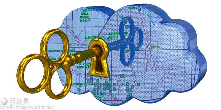
Oil and gas companies moving toward Big Data analytics are missing a critical dataset in their analytic data pool by keeping information locked up inside legacy seismic media, paper logs and well files. Transforming legacy media to modern technology and scanning well files from paper to digits is part of Katalyst Data Management’s initiative to digitize the world. By creating a searchable, accessible digital version of all data types, from well files to interpretation projects to seismic data, Katalyst provides exploration companies with the ability to capture the value of both historical and current data in their analytics platforms and interpretation software. Katalyst’s iGlass software supports a multicloud architecture for both data and metadata. Now Professional Petroleum Data Management Gold Compliant, iGlass allows users to access multiple subsurface data types from a single Esri GIS map interface. katalystdm.com
A new way of acquiring and processing marine seismic data
The next phase of the PGS technology evolution is known as eSeismic and involves the use of continuous source and receiver wavefields to fundamentally change the way that marine seismic data are acquired and processed. This method is under development in the company’s R&D unit, and the potential benefits include reduced environmental impact, improved efficiency and better data quality. Peak sound pressure levels and sound exposure levels can be significantly reduced by distributing the emitted signals from the sources in time. From an efficiency standpoint, there are no speed limitations because the method does not require the seismic recording or the sources to be triggered with specific spatial intervals and also because no listening time is needed. Rapid coverage of the target during acquisition by operating several sources simultaneously and increasing the spread width of the sources also improves efficiency. Data quality is even better with potential uplifts related to the continuous wavefields and to the spatial sampling of source positions. The imaging of low-frequency signal benefits especially from the long records. The continuous sources wavefields can be generated with either marine vibrator technology or with traditional air gun hardware. https://www.pgs.com/eseismic
Modules help solve complex structural, stratigraphic challenges
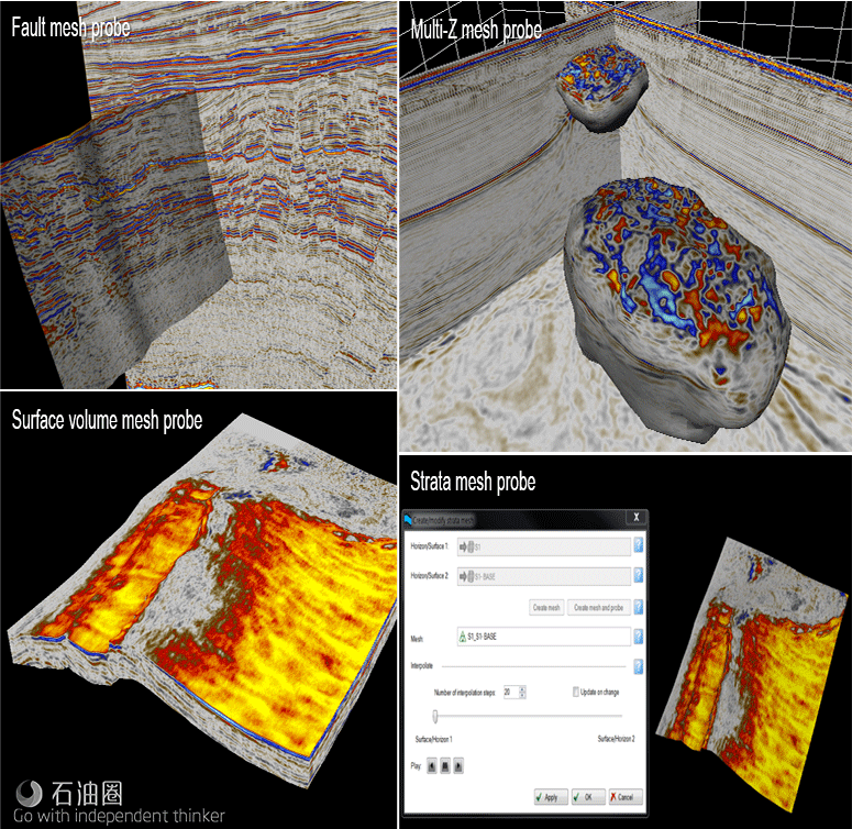
Schlumberger’s DELFI cognitive E&P environment petrotechnical suite along with the company’s Petrel E&P software platform modules, including the geology and geophysics, provide seismic and quantitative interpretation to the geophysics community. These modules enable E&P operators to solve the most complex structural and stratigraphic challenges from regional exploration to reservoir development. At the SEG conference, technical experts will highlight machine learning, high-performance computing, data ecosystem and the new Petrel platform features focusing on increased accuracy in seismic rendering with the introduction of seismic mesh probes. In addition, booth attendees will learn about management of seismic reference datums and streaming of real-time mud log data in the well section. With these new technologies, petrotechnical domain experts can work seamlessly in a unified, collaborative environment to make the most informed decisions from reservoir characterization to completion and production. slb.com
Software evaluates size and quality of oil and gas reservoirs
Sharp Reflections uses Big Data computing technology to evaluate the size and quality of oil and gas reservoirs and reduce predrill risk. The company’s Pre-Stack Pro (PsPro) software, using a highly parallel, in-memory compute architecture, supports interactive visualization and analysis of prestack and post-stack seismic data. Using a rich toolkit, which includes integrated processing-amplitude applications and specialized prestack azimuthal and inversion modules, the company processes, analyzes and interprets full fidelity raw signal from conventional and unconventional 3-D seismic datasets to predict reservoir and fluid properties away from well control. All PsPro applications can seamlessly be scaled to multiple servers or executed on the company’s Amazon Web Services cloud-hosted resources to interactively analyze terabyte- size datasets in hours. sharpreflections.com
Using refractions, reflections to create 2-D and 3-D velocity models
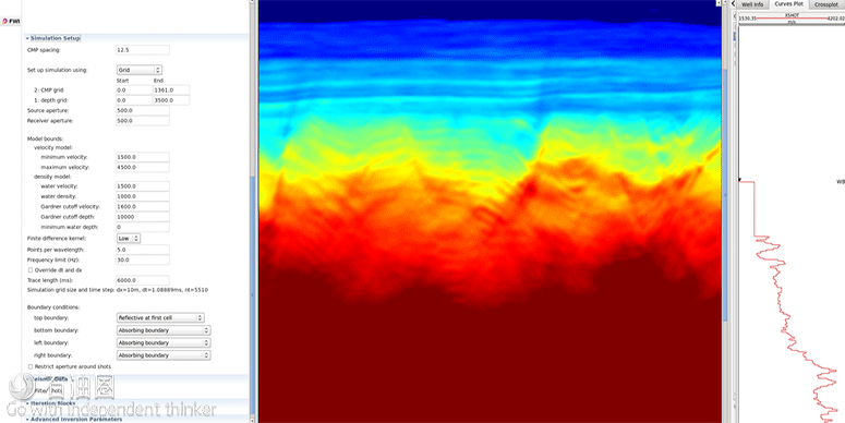
Shearwater GeoServices’ full wavefield inversion (FWI) offering is an implementation of the latest in inversion technology developed by Imperial College, London, for the FULLWAVE consortium. Intense research over the last eight years has resulted in an algorithm to gives users a velocity field over frequencies previously considered impossible. Used within Reveal’s modern architecture, system users can easily move from time processing to depth imaging in a single user interface. With the continuing research being carried out by Imperial College, Shearwater is ensuring the future of FWI in Reveal. The company offers an advanced FWI algorithm in Reveal, utilizing all refractions and reflections to create the most accurate velocity model—in 3-D to the company’s fellow consortium members and 2-D to all nonmembers. shearwatergeo.com
Systems provide real-time data acquisition
Wireless Seismic provides the industry’s only fully scalable wireless seismic recording systems with real-time data acquisition. Wireless Seismic’s RT2 is a field-proven wireless seismic recording system with real-time data transmission for conventional surveys and passive monitoring projects. RT2 features new electronics that have reduced the system’s power consumption by approximately 50%. RT3 is Wireless Seismic’s next-generation seismic recording system that addresses the growing need to deploy ultrahigh channel counts for larger and denser seismic surveys. RT3 delivers full real-time data transmission via a new high-performance radio telemetry system that operates up to seven times faster than traditional cabled systems. METIS is a collaborative R&D program, in partnership with Total and other technology innovators, that aims to significantly reduce the costs and turnaround time associated with exploring in hard-toaccess areas, such as foothills. The seismic acquisition components of METIS are based on the real-time and high-performance radio telemetry of RT3. wirelessseismic.com

 石油圈
石油圈