Baker Hughes has a fully integrated range of tools and services to speed development of and maximize the return on your tight gas assets throughout the life cycle. They have been increasing tight gas project efficiency for our customers around the world since the early 1990s.
Their reservoir groups have many years of experience evaluating tight gas reservoirs and analyzing natural fractures. Their knowledge of formation geomechanical properties and the stresses on the fractures can offer you unique insights that optimize tight gas well placement. Reservoir analyses and geomechanical models guide you to drill and frac the most precise tight gas well, particularly at the critical vertical section.
UltrasonicXplorer Imaging Service
The Baker Hughes UltrasonicXplorer? imaging service provides high-resolution borehole acoustic images in difficult wellbore conditions, including oil-based muds and large boreholes. These images provide valuable insight for making drilling, completion, and production decisions at the wellsite.
Using a rotating acoustic transducer operating in the pulse-echo mode, the UltrasonicXplorer service attains full 360° image coverage. The transducer scans the entire circumference of the borehole wall, providing sharp images and boundary delineation.
The instrument operates reliably in both water-based and oil-based muds. The lower operating frequency (250 kHz), along with downhole digital signal processing (DSP), allows for superior performance in larger boreholes and in highly attenuating muds when compared to other similar devices.
Since the UltrasonicXplorer system is an acoustic device that does not require contact with the borehole wall, it is quite effective in horizontal wells. Its small size, 3.625 in. (92 mm), allows for operation in slim holes, as well as in large-diameter holes up to 16 in. (406 mm).
The tool provides an acoustic amplitude image and a travel-time image. By calibrating the travel-time image, it is possible to provide a high-resolution borehole shape.
Features and benefits:
Measures acoustic amplitude reflectance and two-way travel-time in water- and oil-based mud systems;
Reliably operates in any mud type;
Advanced DSP and lower operating frequency, obtains accurate measurements in large boreholes and heavy mud;
Full 360° coverage of the borehole with images containing up to 256 data samples, complete data for identifying formation features.
EARTH Imager Formation Resistivity Imaging Service
EARTH Imager
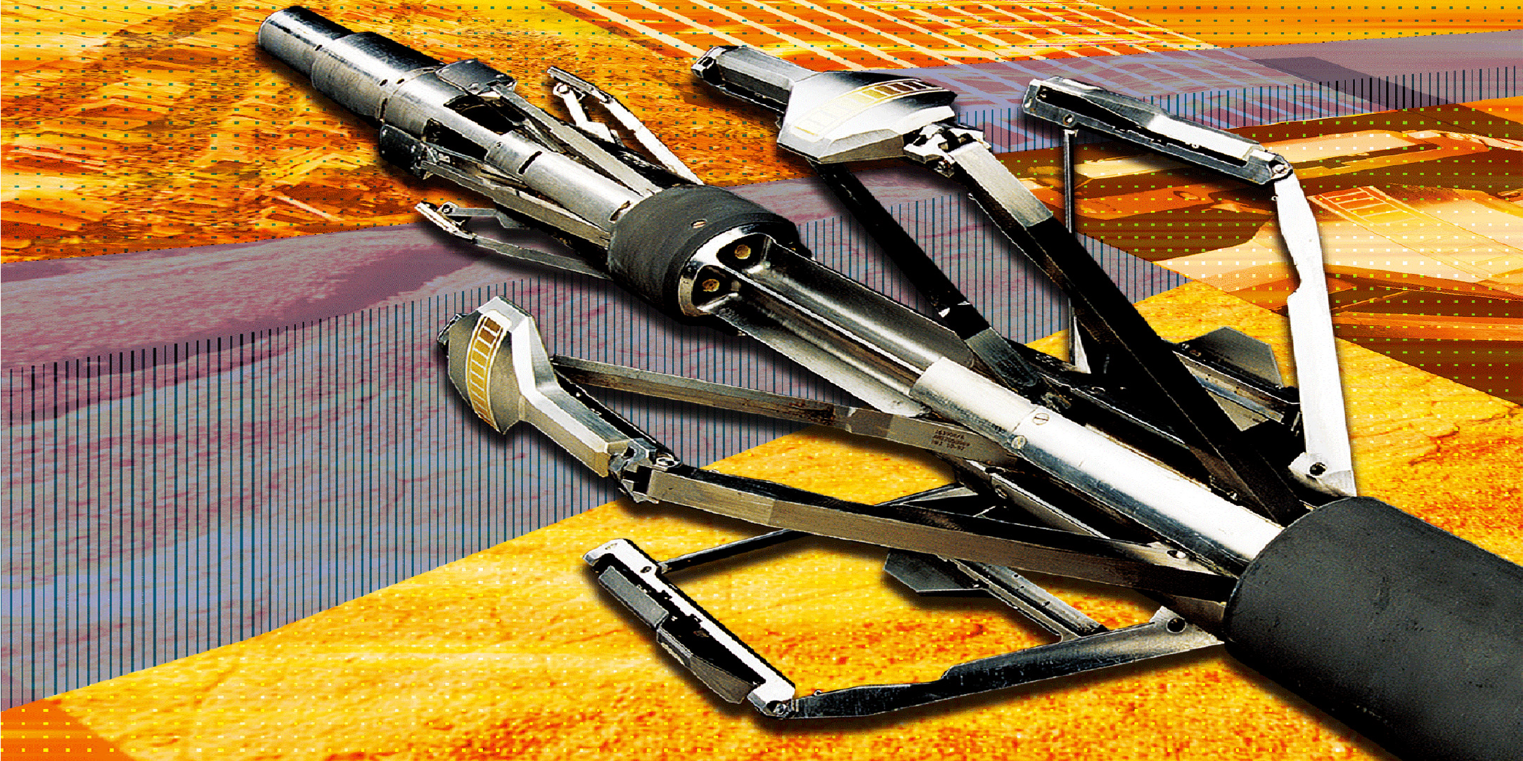
The Baker Hughes EARTH Imager formation resistivity imaging service delivers high-resolution micoresistivity images in wells drilled with nonconductive oil-based mud systems. It offers significantly improved vertical resolution and borehole coverage when compared to other available systems. The EARTH Imager service uses advanced electrical conductivity measurements allowing for petrophysical and geological evaluation at a much greater resolution than previously possible in oil-based mud systems.
High-resolution borehole images are acquired by an independently articulated six-arm carrier and a power standoff design, ensuring optimal sensor-to-formation contact, even in highly deviated wells. Each of the six arms has a pad with eight sensors, resulting in 48 microresistivity measurements that capture detailed features for identifying bedding, fractures, faults, stratigraphic features, and borehole wall features such as breakout and drilling-induced fractures.
Features and benefits:
Six-arm carrier, each arm with eight sensors per pad, provides high-resolution images in oil-based mud systems;
Combinable with acoustic imaging services. Simultaneously acquires microresistivity, acoustic, and ultrasonic images. Additional interpretation opportunities with complementary data and saving rig time;
Wide range of integrated geoscience processing and interpretation services, provides range of solutions from image processing to complex multi-wall sedimentological study.
UltrasonicXplorer and EARTH Imager Services Deliver High-Quality Image Log in Fractured Tight-Gas Reservoir
An operator in the Tarim Basin of China encountered faults and fractures in a tight-gas reservoir that strongly inhibited production. A high-resolution image log was needed to detail the fractured formation with a 6.625-in borehole section in a heavy oil-based mud (OBM) system, a maximum deviation of 9° at 23,012 ft (7014 m), and a maximum temperature of 324°F (162°C).
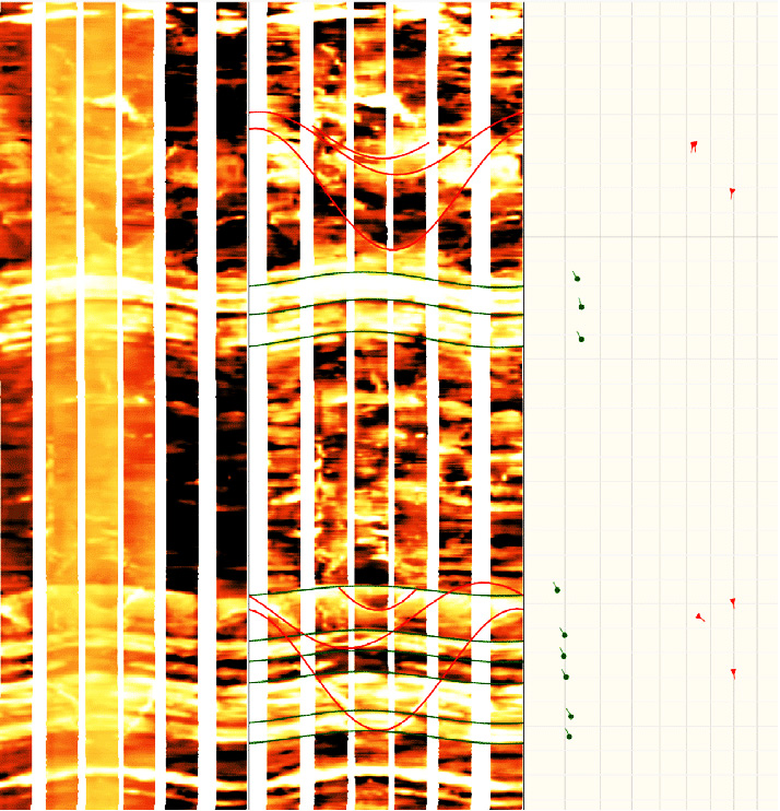
Baker Hughes deployed the UltrasonicXplorer acoustic and the EARTH Imager? resistivity imaging services in a combined logging run from 22,192 ft (6764 m) to 23,045 ft (7024 m) to provide high-resolution and high-depth correlated images. The UltrasonicXplorer service resolved the natural fractures, boundaries, and wellbore conditions (borehole breakout and induced fractures) down to a similar resolution comparable to water-based mud images. The EARTH Imager service resolved the conductive and resistive faults and fractures, beddings, boundaries, and other sedimentary structures and textures.
The complementary measurements from the acoustic and resistivity images provided high-quality data that identified the small faults and fractures of the formation. Additionally, a detailed quality control log and image processing was created to provide a better image log.
By combining these services, a thorough and integrated reservoir characterization and structural analysis was completed in a single run without any lost time. The high-resolution images provided the comprehensive structure of the formation and were used to interpret the detailed faults and fractures. Stratigraphic and sedimentary information was also analyzed, exceeding the operator’s expectations.
Results
Identify faults and fractures in a tight-gas reservoir;
Obtained high-quality borehole acoustic image log in heavy OBM;
Used high-resolution images for detailed faults and fractures interpretation;
Delivered comprehensive structure, stratigraphic and sedimentary analysis.
Challenges
Fractured, tight-gas reservoir;
Identify detailed fracture distribution from image log in heavy OBM;
Deep logging interval from 22,192 ft (6764 m) to 23,045 ft (7024 m);
High temperature up to 324°F (162°C);
Heavy mud weight up to 15.5 ppg (1.86 g/cc).


 石油圈
石油圈

